
Addressing underpins the delivery of many fundamental services to our communities from emergency services dispatch through to the delivery of postal services. The Addressing Working group (AWG) is responsible for standardising the assignment, storage and exchange of addresses to enable the efficient delivery of services from a local level to a federated level across Australia and New Zealand. The AWG aim to support and promote a world leading addressing ecosystem that delivers a single point of reference for all Australian and New Zealand location-based addresses.
ICSM Permanent Committees, Working Groups, and their activities
 AWG
AWG- The GDA Modernisation Implementation Working Group (GMIWG) has government representatives from the Commonwealth, states and territories who have a broad range of knowledge and experience in the surveying and spatial sciences industry. The group is consulting with users and building the tools and technical resources needed to assist with the datum transition. It is working to ensure that the practical implementation of the datum occurs seamlessly and with minimal disruption to existing systems and processes.
 GMIWG
GMIWG - One of the biggest challenges with hydrographic surveying is the relationship between the ellipsoid and chart datum in the coastal environment. With the continuing development of high-accuracy GNSS surveying methods including Precise Point Positioning (PPP) and second generation Satellite Based Augmentation Services (SBAS), the ability to measure the vertical component with the required accuracy and precision to facilitate high accuracy ellipsoidal surveys is now a reality.
 AusHydroid
 - The cadastre of a jurisdiction is its register of property titles and associated data. The Cadastre Working Group (CWG) provides leadership and raises awareness for the cadastre and the benefits of cadastral reform. The objective of the CWG is to develop a cadastral system that enables people to readily and confidently determine the location and extent of all rights, restrictions and responsibilities related to land and real property, whilst improving the effectiveness of data collection and management by custodians.
 CWG
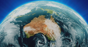
CWG - The Australian Geospatial Reference System is the collection of, datums, infrastructure, models and standards.
Datum
- The ePlan working group was focussed on introducing a digital protocol for the transfer of cadastral data.
ePlan
- Elevation and Depth 2030: Powering 3D Models of Our Nation Elevation and Depth Information Coordinating and Innovating for Australia – A National Strategy. Welcome to Elevation and Depth 2030.
 Elevation
 - The Elevation, Depth and Imagery Working Group (EDIWG) provides a standing panel of experts on high resolution earth observation data drawn from Australia and New Zealand government departments.
EDIWG
- Foundation Spatial Data Framework’s Location Information Knowledge Platform
 FSDF theLINK
 - Geodesy provides the positional framework for all surveying, mapping and geographic information applications in Australia.
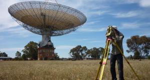 GWG
GWG - The Metadata Working Group will support a wider understanding and consistent application of location information metadata, based on agreed standards.
 MDWG
MDWG - The place names working group brings together place naming experts from Australia and New Zealand. Place names reflect the relationship between people and place and create a link that forms the basis for communication, location and addressing. the primary focus of the working group is developing resources to support place naming that is inclusive, equitable and reflects the diversity within our communities. the working group is responsible for delivering standardised place naming practices, principles and advice to deliver place naming that meets the needs of the community.
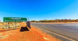 PNWG
PNWG - All–Hazards Symbology Special Interest Working Group
 OTHER
OTHER - The Geocoded National Address File (G-NAF) contains all physical addresses in Australia. It is a composite of information supplied by each state and territory government addressing agency, as well as some Commonwealth government agencies. The address data includes the state, suburb, street, number and coordinate reference (or “geocode”) for street addresses in Australia. More information about G-NAF is available on the Geoscape web site.
 GNAF
GNAF - The S-100 Universal Hydrographic Data Model The International Hydrographic Organization (IHO) S-100
 S-100WG
 - The International Hydrographic Organization (IHO) S-100 data model is the baseline for the Common Maritime Data Structure (CMDS), which defines what data should be exchanged in e-Navigation (MSC 90/28, paragraph 10.10).
 SIDA
SIDA - Providing leadership in assigning addresses, naming of roads, and defining localities. This includes setting related standards, developing addressing guidelines, and promoting systems for the efficient interchange and sharing of address data.
AWG
- Coordinates national databases of tidal records; as well as developing national standards and best practice guidelines for tides and mean sea level related matters.
 TSLWG
TSLWG - The Topographic Information Group was established in recognition of the long-term, on-going need for a coordinated approach to topographic data collection, management and delivery.
 Topo
Topo - TWG Terms of Reference ToR 1: Develop a transport data model with jurisdictions and PSMA in line with the ANZ Foundation Spatial Data Framework. The Transport Working Group would look at providing subject matter advice on roads, rail, water and air into an integrated transport model in alignment with the Foundation Spatial Data Framework being developed under ANZLIC. The Working Group would follow a similar process that was used for roads, namely:
 TWG
TWG - The Water Network Newsletter for the ICSM Water Special Interest Group (WSIG) Summer 2015 Happy New Year! We hope you had an enjoyable, restful break and no doubt back into work like we are. The Water Special Interest Group has been delayed due to the governance of these working groups being discussed by the Permanent Committee on Topographic Information (PCTI) at the teleconference in November 2014. PCTI approved reforming of the Water Special Interest Group and it is hoped the next teleconference will be scheduled shortly.
 WSIG
WSIG